

For this church: |
West Burton St HelenArchaeology
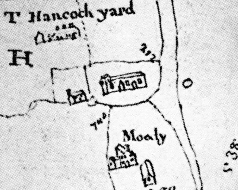
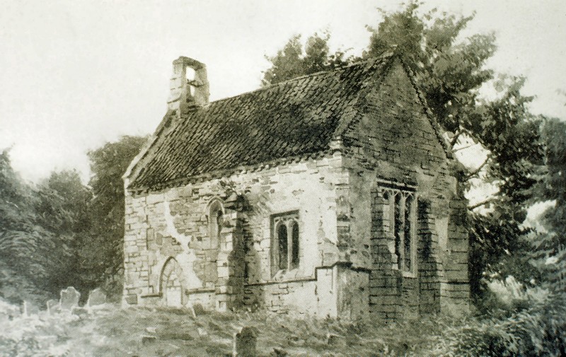
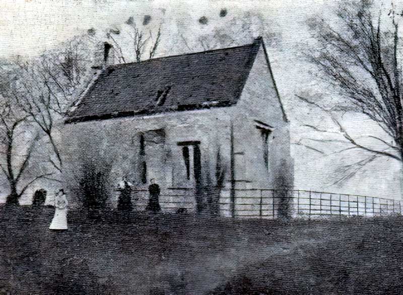
The earliest graphic record of the church is a rough sketch of it on a map of the village dating from c.1750. It appears to consist of nave and chancel with possibly a bell turret over the west gable. There are two other illustrations of the building: a watercolour from c.1875 and a grainy photograph taken in c.1885. Both show the church in a considerably reduced form – a single cell with a bellcote on the western gable. This probably represents the former chancel of the church, clearly in a parlous condition, buttressed on the south and east walls probably in the 15th century. The east window and eastern window of the south wall are respectively three- and two-light windows of the 15th or early 16th century. A central lancet window in the south wall and a blocked doorway towards the west of the same wall appear to be 13th century in form. There is a clear vertical joint towards the west end of the south wall, probably indicating rebuilding when the nave was demolished. Construction was generally of ashlar but with indications of coursed rubble work in the south wall. The roof appears to be of pantiles which may indicate a date in the 18th or early 19th century. There is a single bell depicted in a bellcote above the western gable of the church; its details are entirely unknown. The bellcote was an Elphick type ‘A’, Pickford Group 9.A. As two bells were recorded in 1764, it may have been altered, or there may have been a tower at this time. Burials appear to be shown to the south, west, and north-east of the church in the form of standing grave-markers. Excavations and potential for survival of below-ground archaeologyNo known archaeological excavation has been undertaken at this church. The site is now a Scheduled Monument, No. 29915. The building has been demolished entirely, and only below-ground deposits now remain (although some fittings have been dispersed to other local churches). The site is represented by an earthen mound. The churchyard still remains and is approximately rectangular, 43m x 25m, and contains some standing and many fallen grave-markers. The overall potential for the survival of below-ground archaeology in the churchyard is considered to be MODERATE-HIGH comprising burials, medieval construction evidence, evidence of the modification to the medieval church, and its eventual demolition. Below the site of the former building it is considered to be HIGH-VERY HIGH comprising medieval-19th century stratigraphy with an unknown level of destruction at the time of demolition in the late 19th century and due to subsequent weathering. A full topographical survey of the site was carried out in 2008-9 by Andy Gaunt on behalf of Nottinghamshire County Council and Nottinghamshire Community Archaeology. A copy of the report is lodged in the Historic Environment Record at Trent Bridge House, West Bridgford, and it is also available as a downloadable PDF. |
![]()
Introduction | Location | History | Archaeology
Fittings | Glass | Organ | Bells | Clock | Stonework | Monuments | War Memorial | Churchyard
References | Pictures | Plans | List of Incumbents
Project: Home | Index | About | People | What's new | Resources
![]()
 |  |  |  |