

For this church: |
Thorpe St LaurenceChurchyard
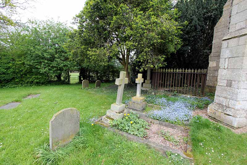
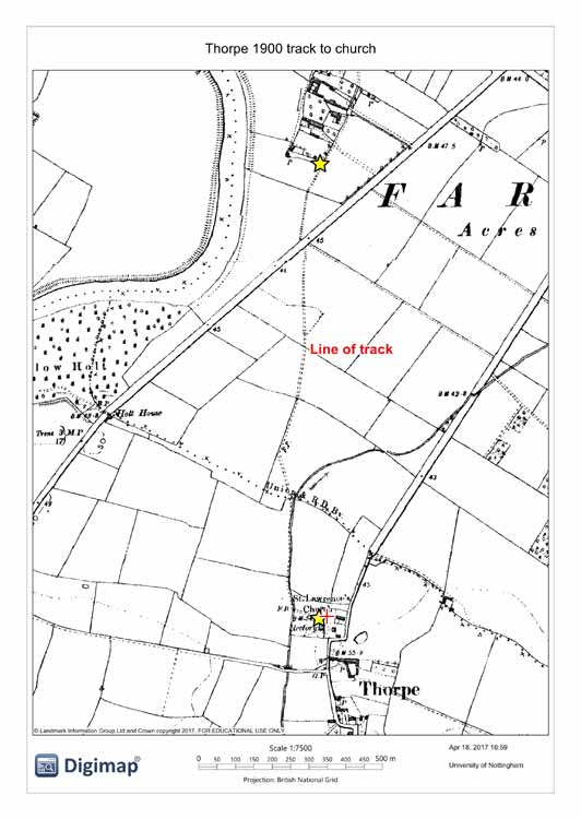
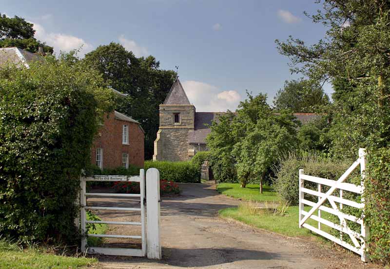
The churchyard is square in shape, 0.18 ha in extent, with the church offset to the south side. There is a single entrance path through gates from the old rectory grounds and the building is surrounded on all but the west side by other properties. In 1885 the position was similar but with no buildings to the north and an additional trackway leading to the churchyard across the adjacent field to the west (see the map in Plans section). This trackway is shown well defined as leading to Farndon and appears to have been a specific route from the village to Thorpe church; it still existed in 1956 but by 1972 is shown terminating at the Fosse Way from the Farndon end; however, a path once again exists from Farndon to Thorpe (with a long diversion over the modern A46) though it technically bypasses the church. The boundaries on all sides comprise a mixture of hedges and mature trees and there are further mature trees in the churchyard. There is a gateway from the grounds of the old rectory (built c.1830) to the south and a small gate leading into the field to the west. There is evidence of burial on all sides, though many grave markers have evidently been removed and the most obvious are now located at the south-west corner of the church. Immediately to the west of the tower is a railed enclosure with large stone ledger slab to members of the Townsend family dating from 1855. |
![]()
Introduction | Location | History | Archaeology
Fittings | Glass | Organ | Bells | Clock | Stonework | Monuments | War Memorial | Churchyard
References | Pictures | Plans | Listing Description | List of Incumbents | Parish page
Project: Home | Index | About | People | What's new | Resources
![]()
 |  |  |  |