

For this church: |
Misterton All SaintsChurchyard
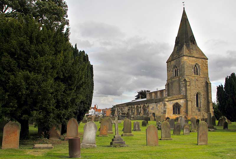
The churchyard is trapezoidal in shape, tapering from a long side at the west to a short frontage on the east where it faces onto the main street. The church is curiously positioned in the extreme south-east corner and even allowing for the possibility that the churchyard may once have been shorter to the west, it is still heavily offset to the south. There are burials on all sides of the church though, by position, space is heavily restricted to both south and east. The boundaries of the churchyard comprise, to the east a low stone wall, into which is inserted a modern gate, which continues on the north side for approx. 46 m before changing to a brick wall of the same height built in stretcher bond; there is a small pedestrian gateway, topped by moulded stone, allowing access to the churchyard through the brick wall. The walls all appear to be 19th century or later. A mixture of 20th century walls and hedges demark the western boundary, separating the churchyard from a single, modern dwelling house. To the south, there is a brick wall of two clear phases at the western end, marking the boundary between Church Lane, and from here a path runs along the southern boundary into the churchyard where the ends of buildings belonging to Church Farm and a mature hedge mark the edge.
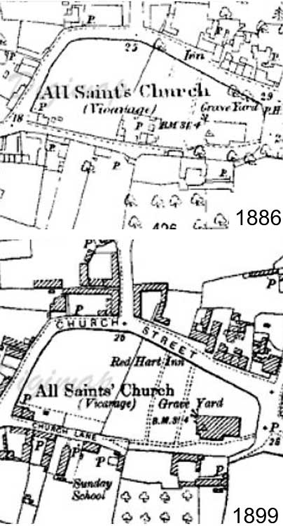
On the 1886 Ordnance Survey map the south-western corner of the churchyard was occupied by several small buildings and a well/water pump implying domestic use. It is possible that these buildings represented the site of the medieval vicarage or priest's house. By 1899 these buildings had disappeared and two tracks running north-south were then marked on the map. The Sunday School to the south of Church Lane which is marked in 1899 had not been built in 1886. |
![]()
Introduction | Location | History | Archaeology
Fittings | Glass | Organ | Bells | Clock | Monuments | War Memorial | Churchyard
References | Pictures | Listing Description | List of Incumbents
Project: Home | Index | About | People | What's new | Resources
![]()
 |  |  |  |